The Loop Between Otter Pond and Goosehole Pond: New London's Quietest Trail Has A Backstory
August 27, 2026
August 27, 2026
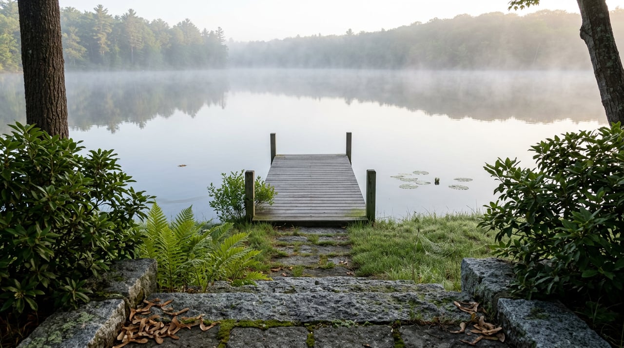
The climb starts easy enough. From the pull-off along Goose Hole Road, the packed-earth path follows the edge of the woods, stone walls tracking alongside it like they've been there longer than the trail itself. Then the quarry appears, tumbled granite blocks half-swallowed by moss, and the grade steepens toward a hilltop clearing where Mount Sunapee and Lake Sunapee open up through the trees. From there it's a 200-foot drop in a short stretch down to the shore of Otter Pond, where two benches sit in the shade waiting for whoever needs a rest before the last quarter mile home.
Most people who walk this loop know it by feel, not by name. Fewer know that the ground under their boots has been protected twice, forty years apart, by two decisions that had nothing to do with each other on the surface and everything to do with each other underneath.
In 1980, a summer resident named Bessie Wright Phillips gave the Town of New London 71 acres straddling Otter Pond, a memorial to her late husband Stephen. It became the Stephen Phillips Memorial Preserve, and the town put it under the care of the New London Conservation Commission, which still manages it today.
Thirteen years later, in the fall of 1993, Phillips was recognized nationally for a gift roughly a hundred times larger: 7,000 acres in Maine's Rangeley Lakes region. Set against that scale, the 71 acres on Otter Pond reads almost like a rehearsal, the smaller, earlier version of a habit that would eventually make headlines. Nobody was watching when she gave it. There was no press cycle, no ribbon cutting captured for posterity. Just a woman who loved a pond enough to make sure it outlasted her.
That order matters. The quiet trail you're walking wasn't an afterthought tacked onto a bigger legacy. It came first.
The preserve holds more than 1,600 feet of frontage on Otter Pond itself and another 700-plus feet along Otter Pond Brook, the stream that carries water down from Goosehole Pond into Otter Pond. Here's what the loop actually looks like on the ground:
| Segment | What you'll find |
|---|---|
| Trailhead | Parking area alongside Goose Hole Road |
| Climb | Packed earth and stone walls, rising past an old quarry |
| Hilltop clearing | Picnic table, views of Mount Sunapee and Lake Sunapee, best when the leaves are down |
| Descent | Roughly 200 feet down to the pond edge over a short distance |
| Shoreline | About a quarter mile along Otter Pond, two benches in shade |
| Total distance | Just under a mile |
The town's own hiking group has been known to meet at the municipal lot across from Tracy Library before carpooling out to the trailhead together, which tells you something about how this loop is used locally. It isn't a destination hike that pulls people in from out of town. It's a Tuesday-morning loop, a dog-walk loop, the kind of trail residents fold into an errand run because the trailhead is five minutes from downtown.
A forestry project moved through the property in 2013, and a cover map was prepared afterward to track how the woods were managed going forward. The preserve isn't a museum piece left untouched. It's working land that also happens to be open to the public, timber production and low-impact recreation sharing the same acreage without much friction.
Here's the detail most people miss on their first few laps: this loop sits on a hill wedged between two ponds, not one. Otter Pond gets the name on the trailhead sign and the bulk of the shoreline mileage, but Goosehole Pond feeds it, sending water down through Otter Pond Brook along the preserve's northern edge.
You can walk the whole loop without consciously registering Goosehole Pond at all, since the trail's views and benches orient almost entirely toward Otter Pond. But the two are connected in a literal, hydrological sense, not just a cartographic one. If you've ever wondered why Otter Pond stays as clear as it does, part of the answer is upstream, in a smaller pond most walkers never see.
Otter Pond carries a mesotrophic classification, meaning its water sits in a middle range of nutrient levels, clear but not sterile, productive but not clouded. The Otter Pond Protective Association, founded in 1980, the same year Phillips made her gift to the town, tracks what that clarity supports: loons, otters, eagles, osprey, bass, and trout among the residents.
That founding-year overlap is easy to skip past, but it says something about what was happening around this pond four decades ago. In the same twelve months, one woman quietly handed over 71 acres of shoreline to permanent public stewardship, and a group of neighbors organized themselves to watch over the water that shoreline touches. Neither act depended on the other. Both were aimed at the same outcome. That's not a coincidence you'd expect to find written down anywhere, but it's the kind of overlap that shows up when you look closely at how a small place decided, independently and more than once, that this particular pond was worth protecting.
The 1980 gift came with conditions but not a permanent lock. That came later. At New London's 2012 Town Meeting, voters approved a conservation easement on the Phillips Preserve by unanimous vote, formally restricting the land from future development regardless of who manages it or what pressures the town faces down the road.
For a walker on the trail, that vote is invisible. There's no plaque at the quarry, no sign at the hilltop clearing explaining what almost happened here or what didn't. But it's the reason the loop will still be there next year, and the year after, in a form recognizable to whoever discovered it decades ago. A gift can be reversed by a future town government with different priorities. An easement, once placed, generally can't be undone that easily. New London chose the harder, more permanent option, and did it without a single dissenting vote.
That's the part worth sitting with on the bench by the shore. The quiet of this loop isn't a leftover from a less-developed era waiting to be discovered by the next round of building permits. It's a standing decision, made twice, forty years and one town vote apart, by people who wanted this specific hillside between two ponds to stay exactly as unremarkable as it is right now.
Walk it enough times and you start noticing the small tells: the fresh picnic table someone hauled up to the quarry overlook, the trail markers at each fork, the way the benches always seem to be in the right spot for whichever direction the wind is blowing that day. None of it happens by accident. Somebody keeps maintaining a trail that, by design, asks for very little attention in return.
If you're the kind of person who already has a favorite bench on this loop, you already understand something about the Lake Sunapee region that doesn't show up in a listing photo. Pamela Perkins spends her days working the shoreline and lake-by-lake nuances of this exact area, and she'd tell you the same thing this trail does: the quiet doesn't happen on its own. Reach out anytime you want to talk about what's happening around the water here.
Discover additional insights, market perspectives, and curated real estate guidance.
With generational ties to Lake Sunapee and a record that defines the New Hampshire luxury market, Pam Perkins represents a level of knowledge, discretion, and performance that few can match. Her clients trust her not only because of what she’s sold — but because of what she knows.
Connect with New Hampshire’s Top Broker